Alaska Highway Part 2 – Free Camping, Double Rainbows and Hot Springs

While the start of our Alaskan Highway experience wasn’t very eventful (other than a busted RV windshield that is) this section all the way to Whitehorse, YK was one pleasant surprise after another!
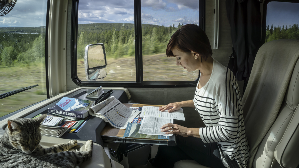
The visitor’s centers along the highway are really some of the best we’ve ever experienced and each has turned out to be a worthy stop filled with helpful information (and free wifi). Our stop at the Fort Nelson visitor’s center was very pleasant and they loaded us up with suggested stops and hiking trails.
As we got further away from Fort Nelson everything started to become more scenic. There were long stretches of road with nothing in sight, tall trees started to line the road, rolling hills came into focus and long meandering rivers followed our path.
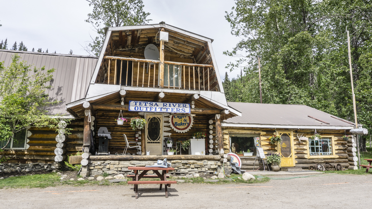
Tetsa River
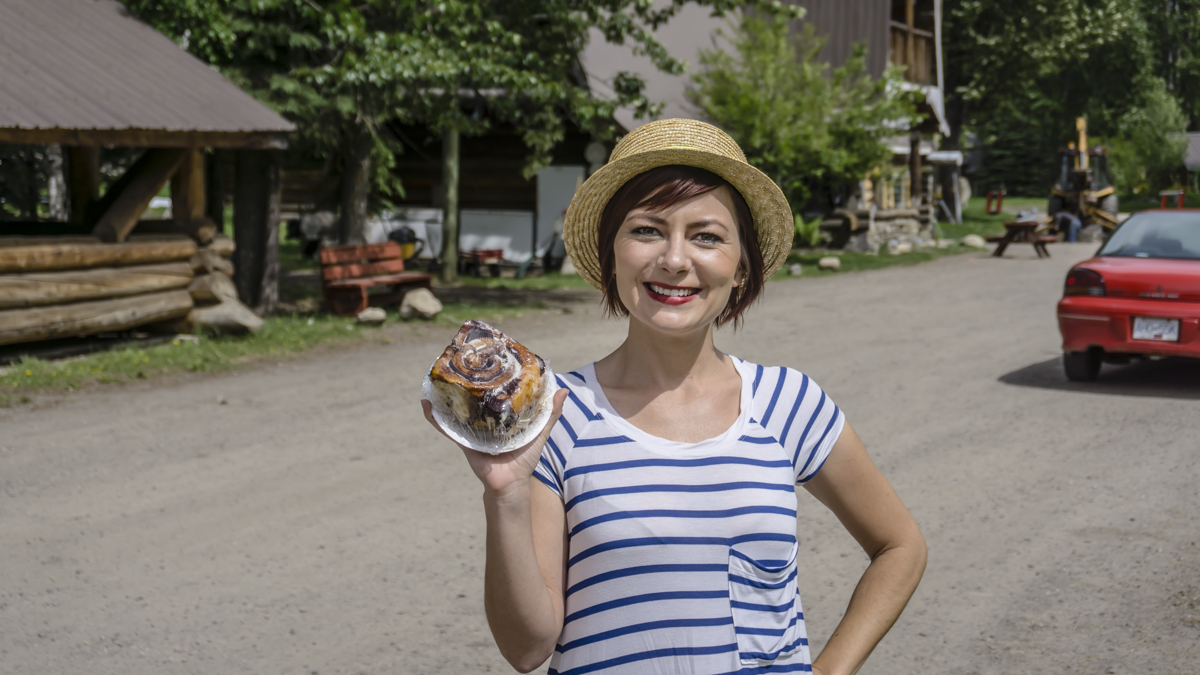
The Tetsa River area held two stops for us. A renowned homemade cinnamon roll from Tetsa River Outfitters at Kilometer 576 and hike to burn off the calories!
Even the cats decided to get in on the action. Cleo was all about the cinnamon roll (she likes to snag bites when she thinks you’re not looking) while Singa was all about getting out the door for a hike!
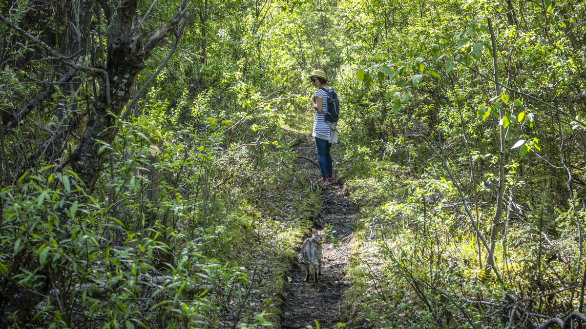
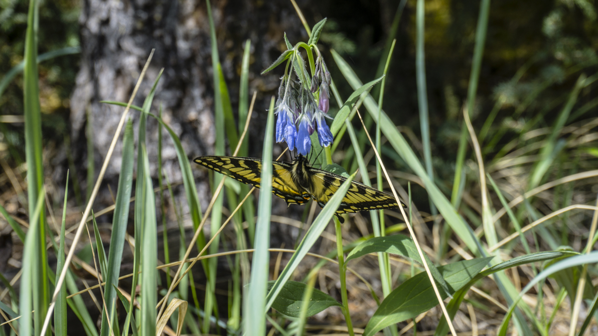
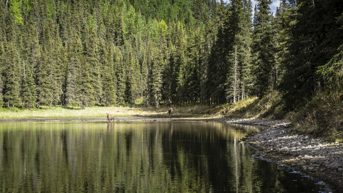
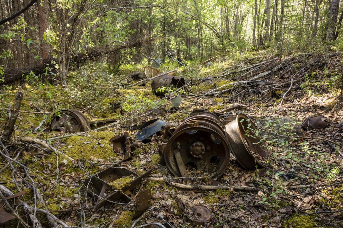
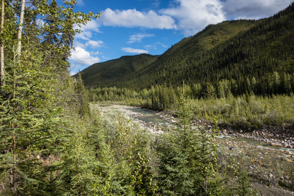
While the serene lake at the end of our Tetsa #1 trail wasn’t anything super exciting (no intense blue waters like some of the others), the baby moose and mama playing in it were loads of fun to watch. Apparently around here, there are more moose than there are people and we’re starting to believe it! On the way back we spotted some old army corps highway building relics (aka trash) that had been left behind (sorry Canada).
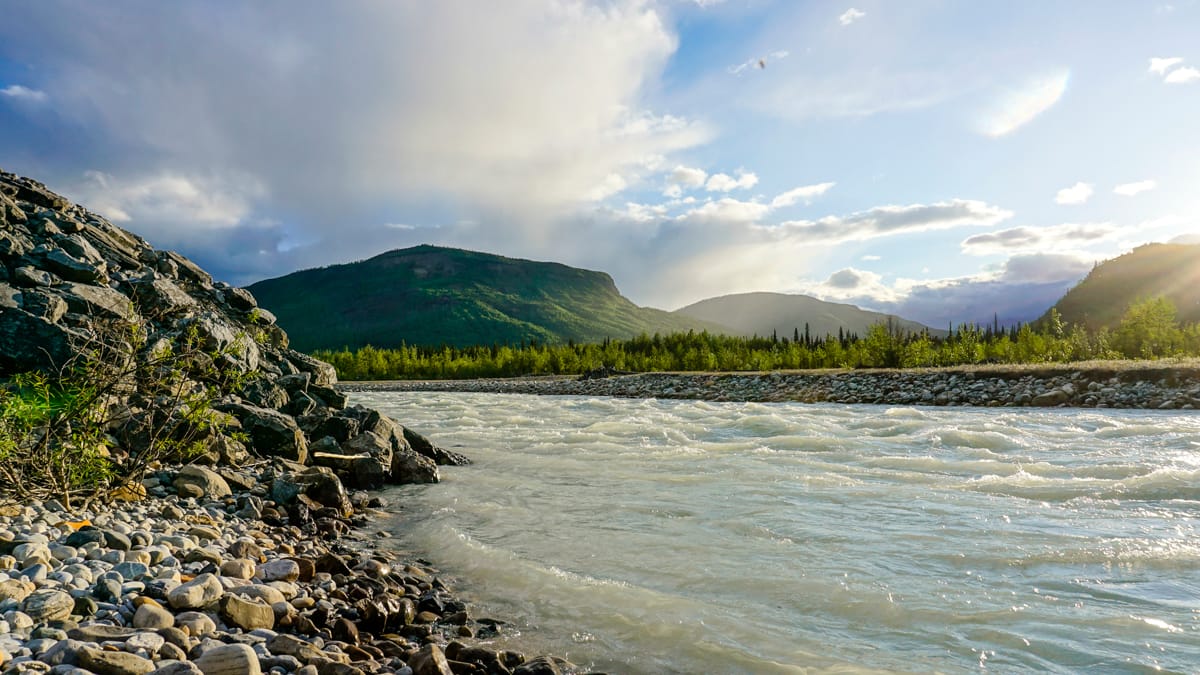
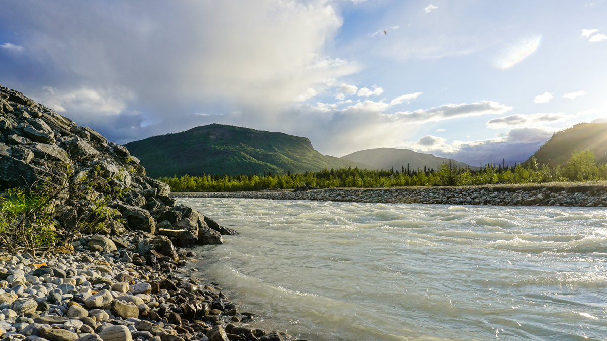
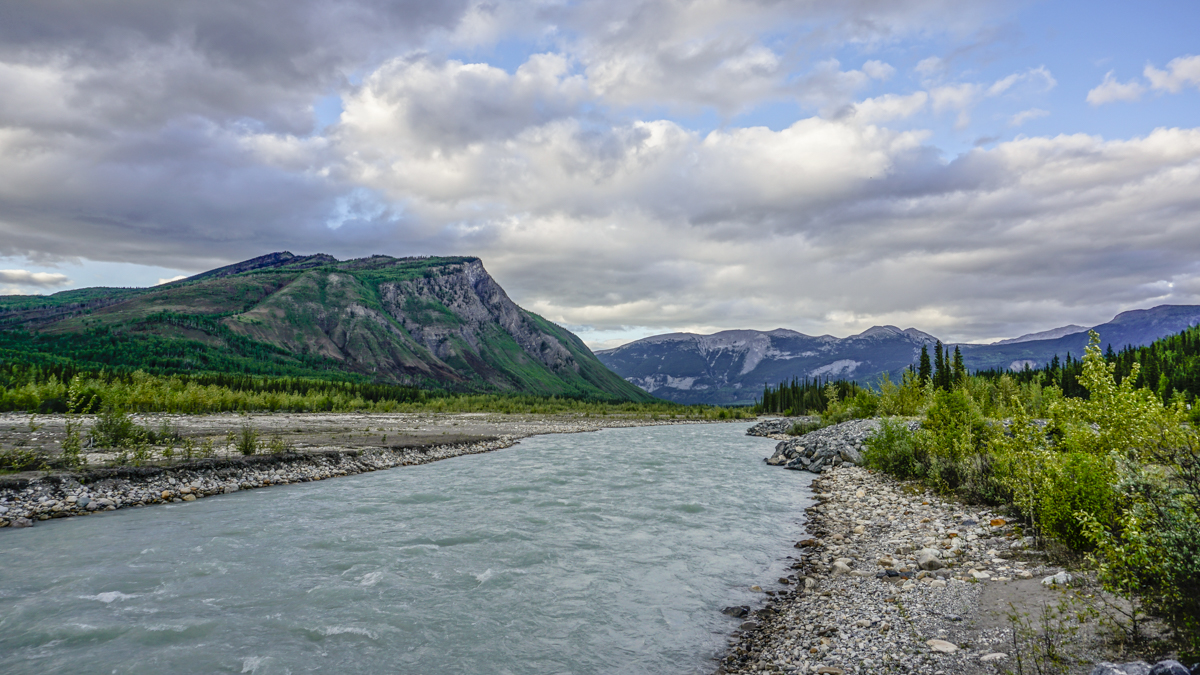
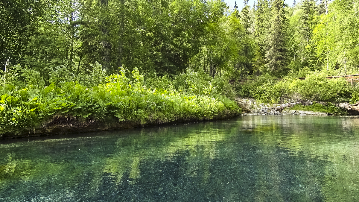
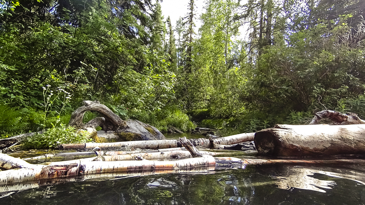
Racing River
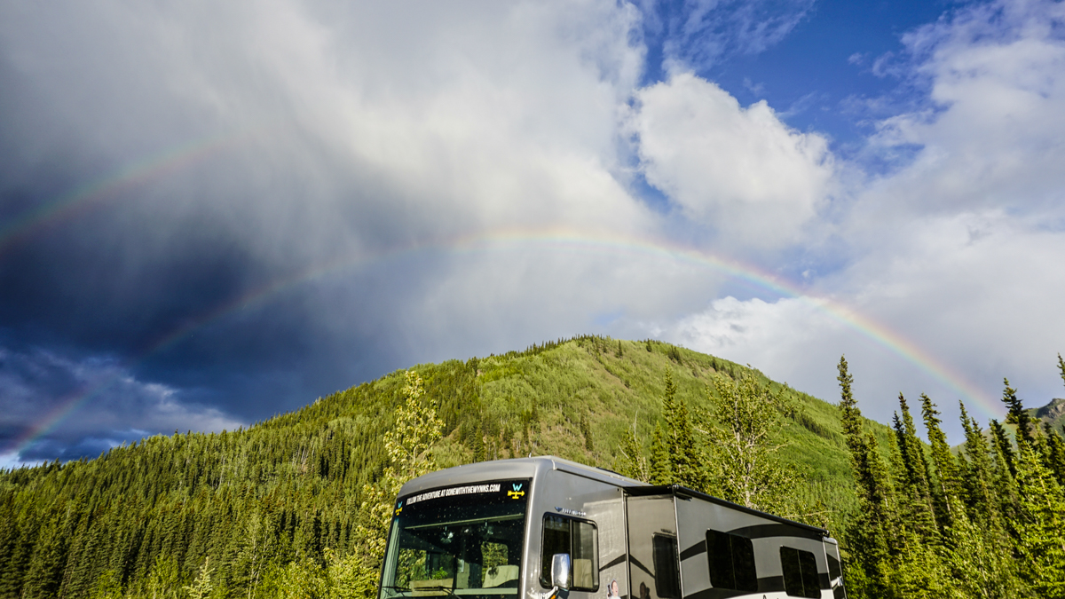
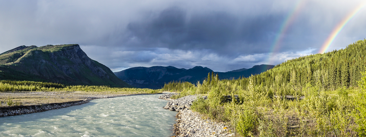
We’ve been dreaming of glacial waters and wild camping ever since we left the Canadian Rockies and oh baby did we find it! In fact…it’s soo good you’ll have to watch the video to believe us. Spoiler alert, we’re not drunk (not even close), just really high on nature.
Pretty flippin’ spectacular right!!! Now this is the kind of camping we drove all the way up here for! We’ve read about and even written about free camping on crown land in BC, Canada before but this was the first time we’ve ever had the pleasure of experiencing it for ourselves (even if it was by accident).
We took down our GPS coordinates and emailed the county for confirmation. They came back to us with the pleasant news that this was indeed crown land – “The area is unsurveyed crown land owned by the government and is frequently used for camping. There are no restrictions on short term parking or camping on this site.” – NorthernRockies.ca
So, if you want to camp in the same glorious spot we did, do a little rain dance and wait for a double rainbow, here are the coordinates: 58.825869, -125.132557
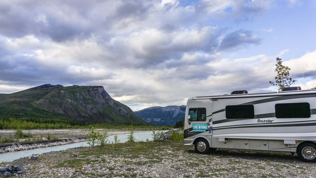
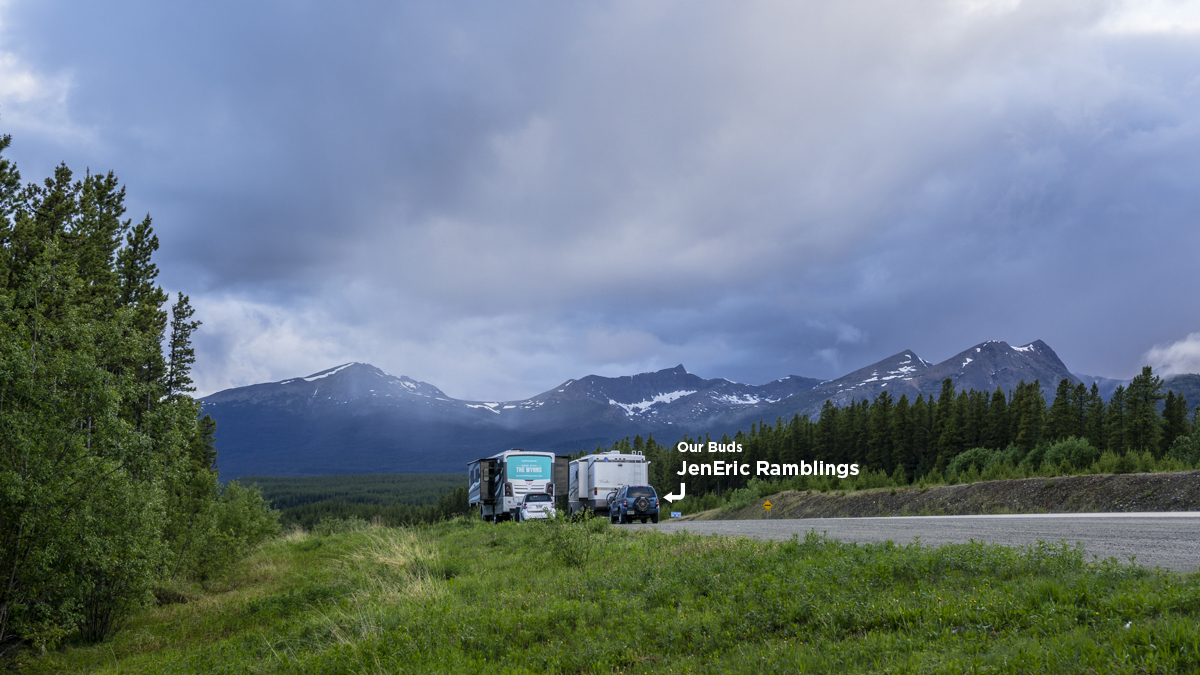
Just as we were packing up our double rainbow campsite, we got a knock on the door! Turns out our friends Eric and Janette of JenEric Ramblings had caught up to us. That’s the beauty of there only being a couple of routes into Alaska, you’re bound to run into friends.
Our next stop was going to be Muncho Lake (which is beautiful) but considering the rain looming in the clouds, we decided to continue on.
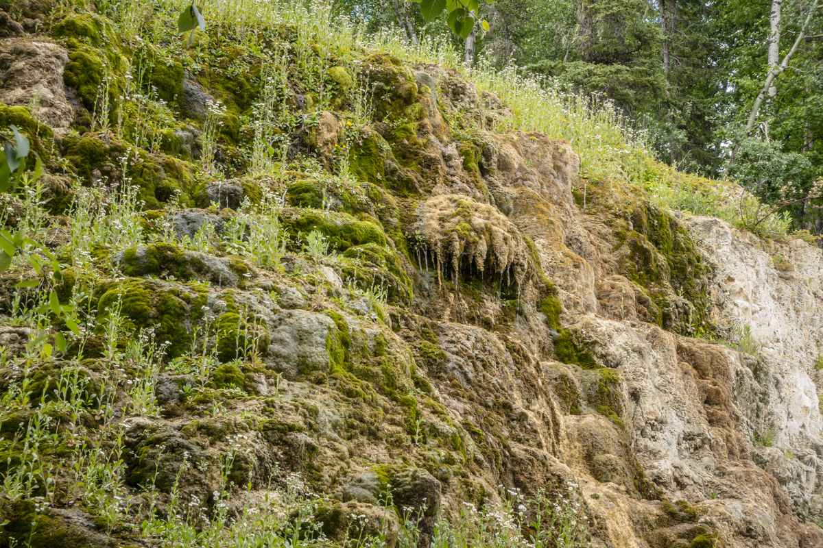
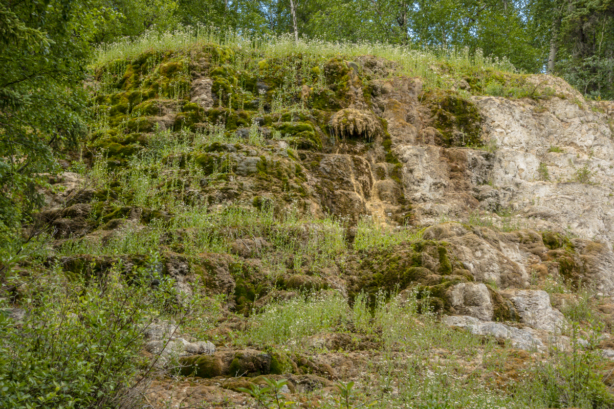
Liard Hot Springs Provincial Park
Hot steamy blue waters and lush greenery surrounding the open air…this turned out to be a hot springs that all other springs should aspire be.
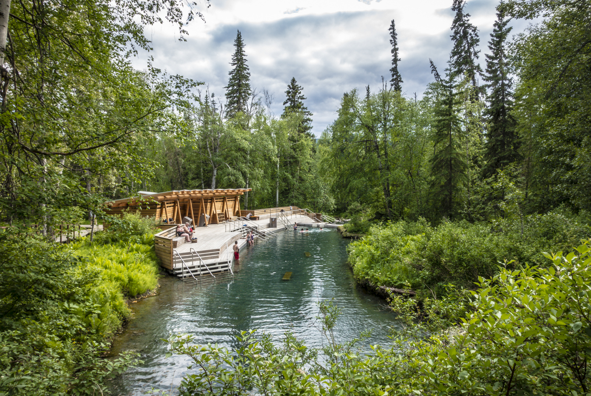
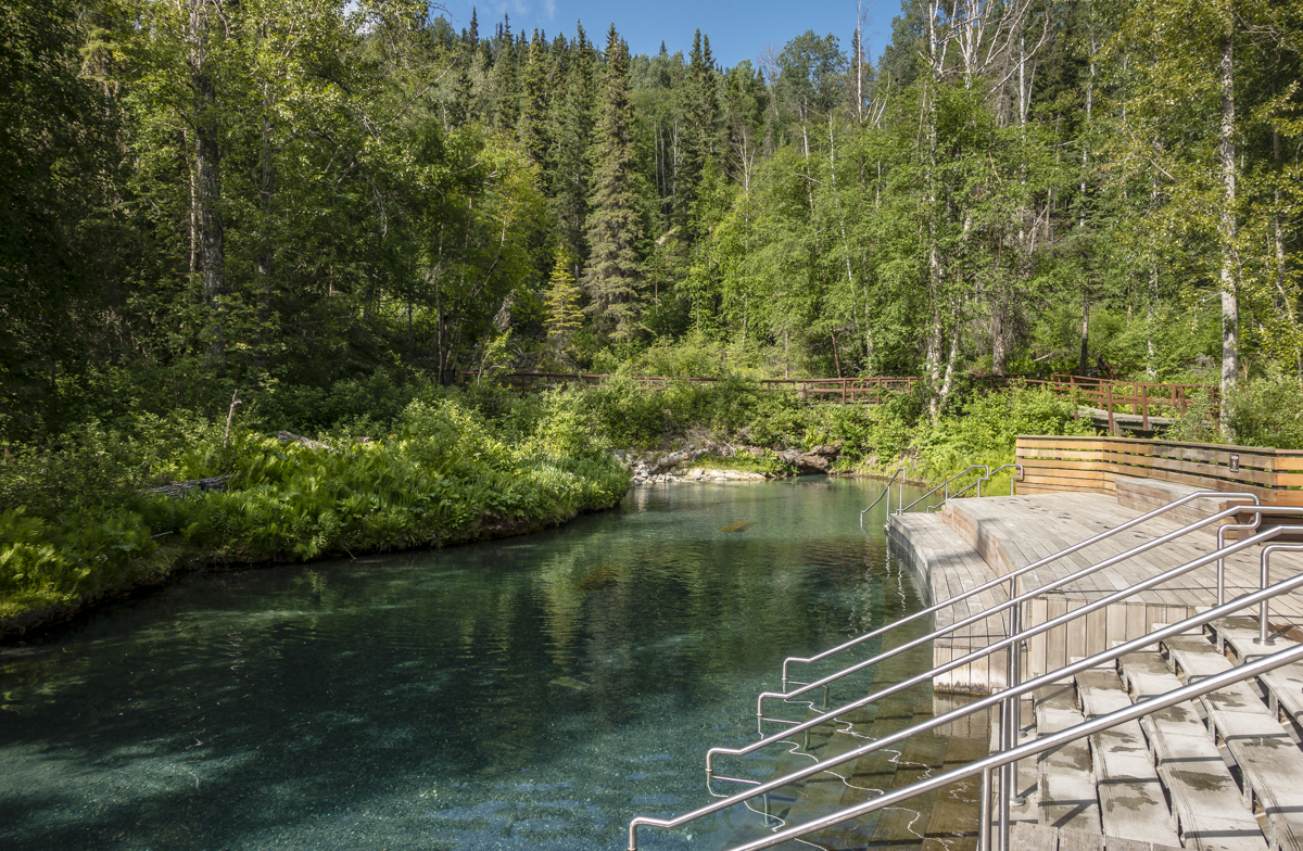
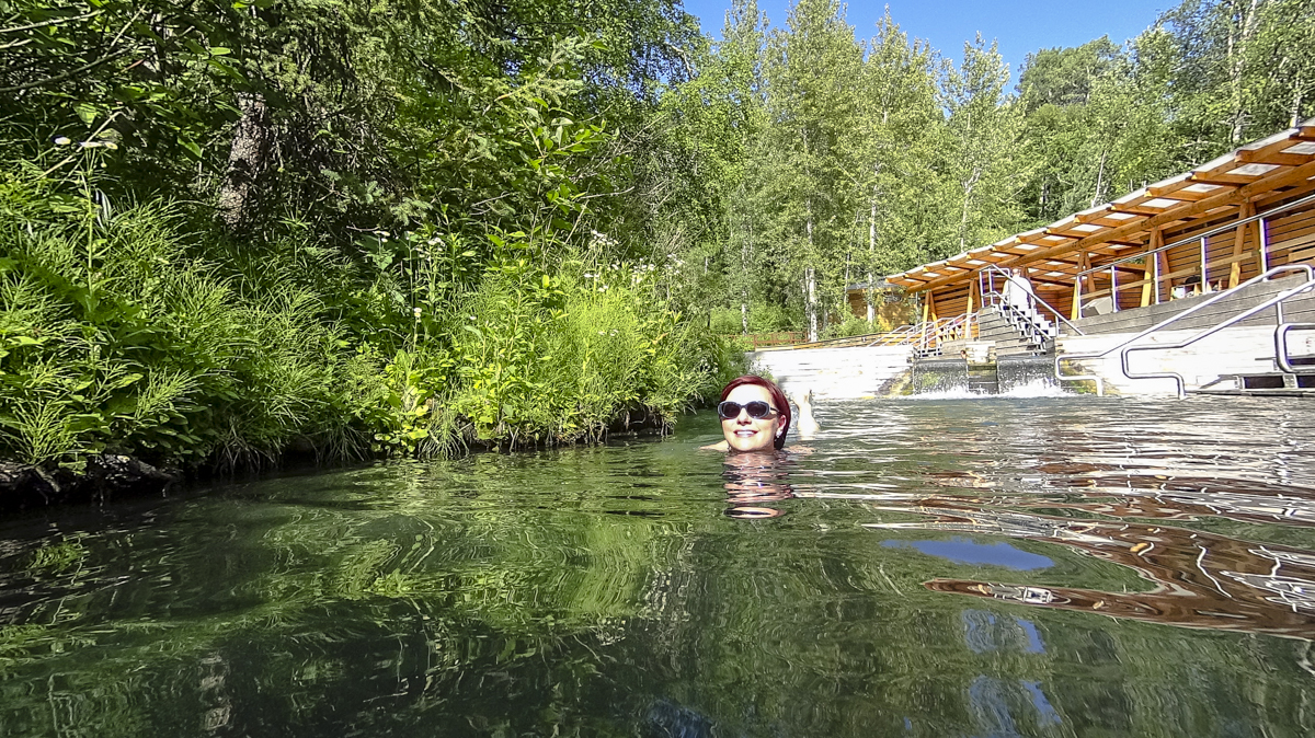
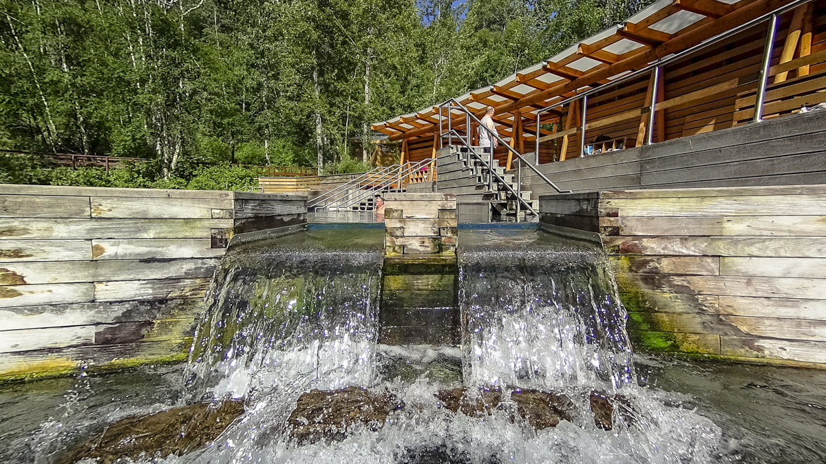
The springs are $10 for day use or free to campers staying in the park. Considering the campground was only $20 a night, it was a bargain. The campground is dry camping only and no dump station but there is a freshwater fill station. But really, here it’s all about soaking, soaking and more soaking. If you don’t come out looking like a shriveled prune, you’re not doing something right.
Watson Lake
Ah, dear Yukon…we’ve been dreaming about you and all your wild wonder for years and its here in this tiny town that we first meet.
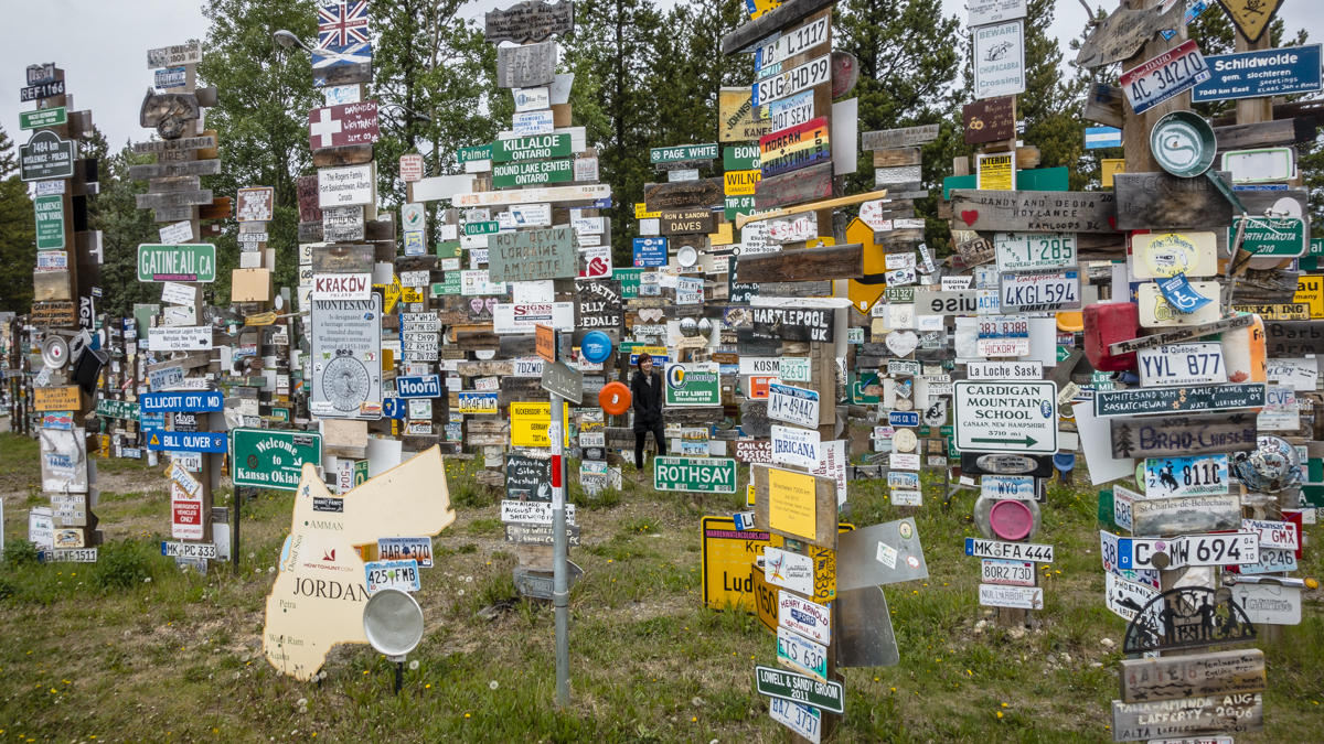
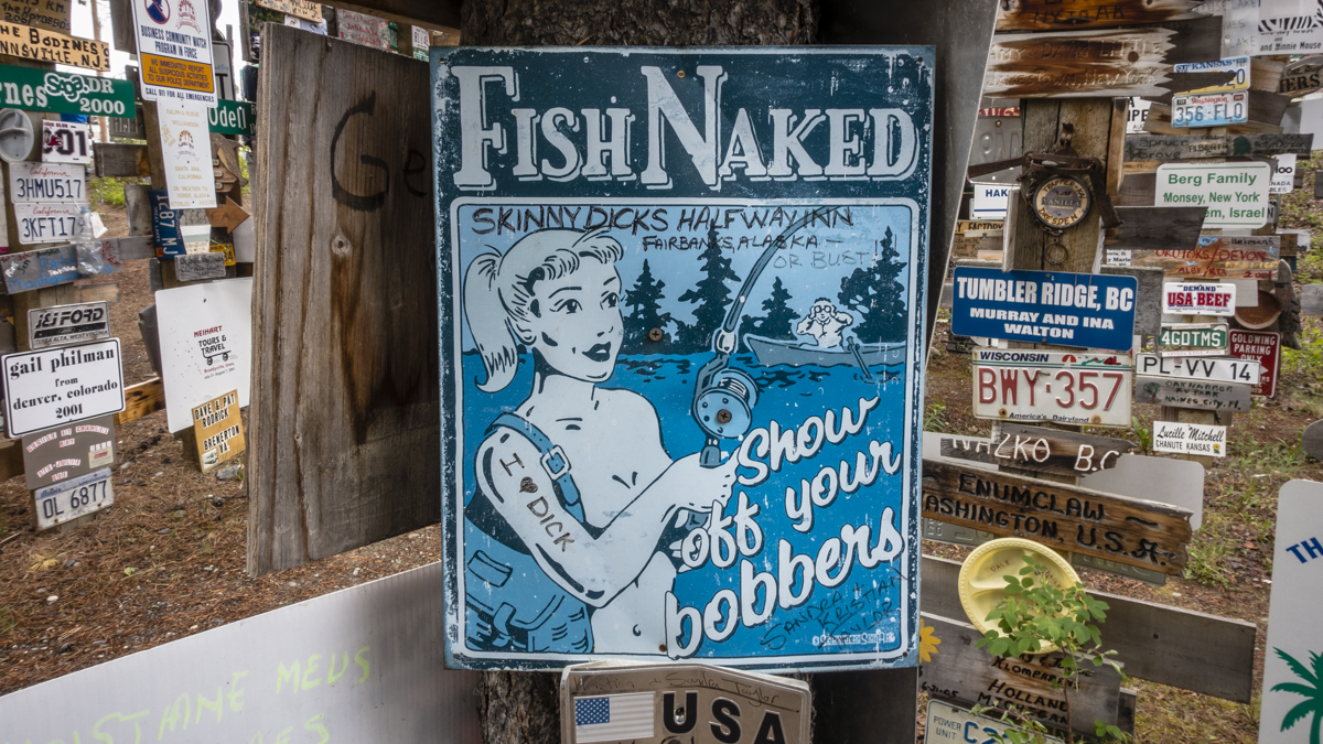
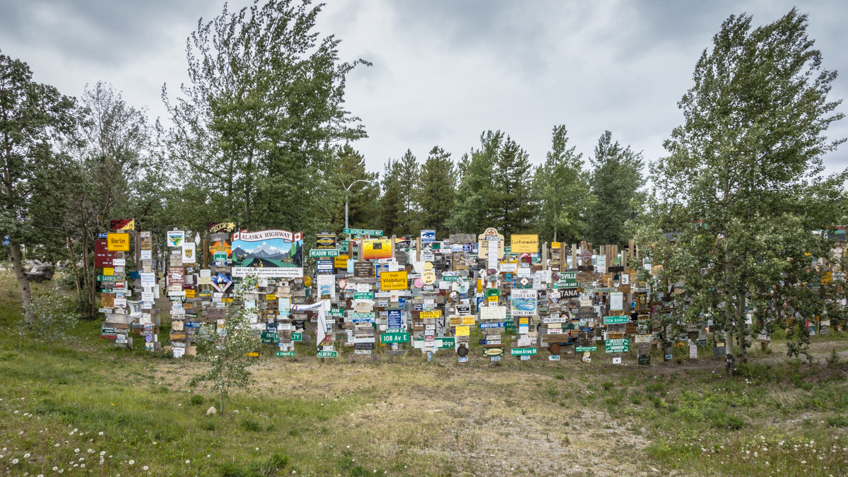
The first thing we (and most anyone) notice here is the famous Sign Post Forest. It’s a fun visual oddity to wander through all of the signs that have come from all over the world (some probably illegally obtained). I found myself drawn to destinations I’ve visited or searching for those furthest traveled. The visitor’s center encourages people to bring their own sign to post and even provides nails and a hammer or pieces of wood and paint if you didn’t come prepared with a sign.
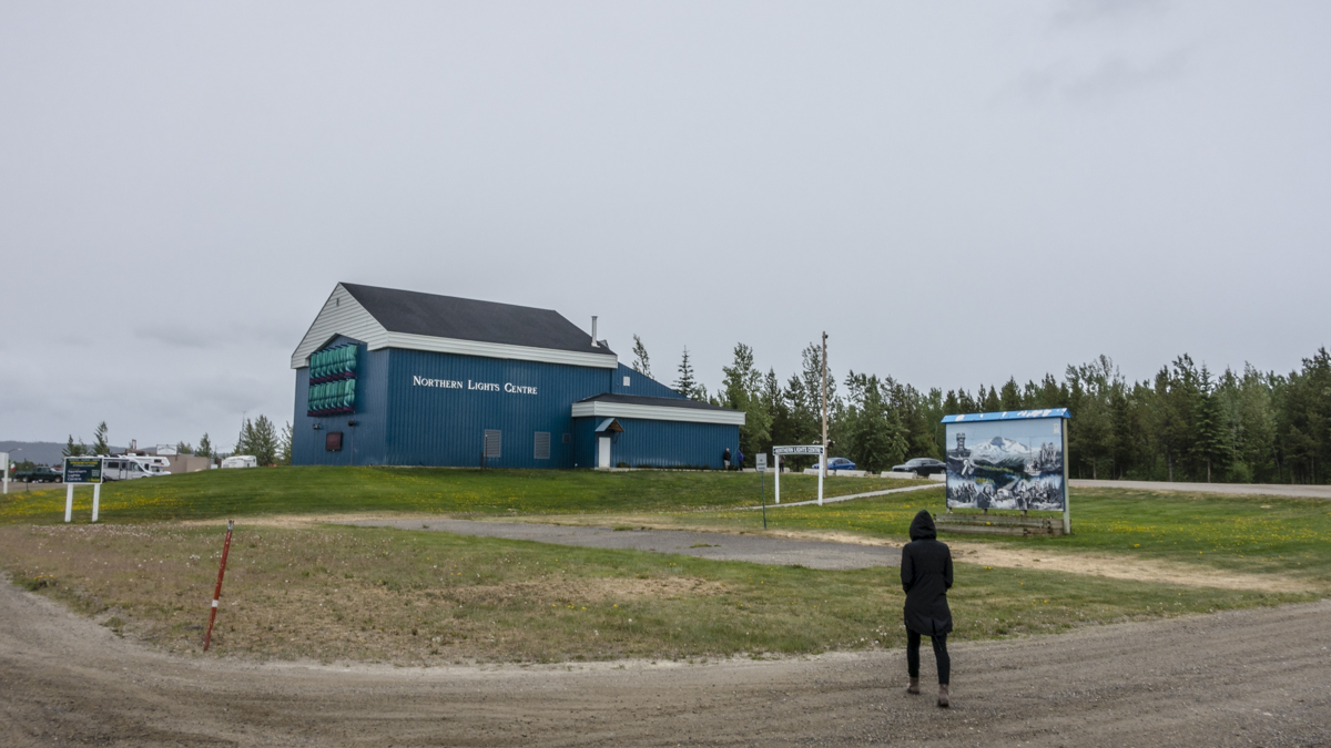
The other big attraction here is the Northern Lights Center. However, I wouldn’t call this a center as much as I would a theatre with a few posters on the wall. It’s $10 for a 50 min. presentation which consists of two different short films. The Black Hole film was created back in 2006 and the Northern Lights portion was released in 2011 but felt older. It’s presented on a rounded planetarium screen that gives an impression that it’s going to be good. Sadly, the quality of the projector was seriously lacking and not up to modern specs so everything felt very faded (dull and dark), not sharp or visually punchy which was such a waste of the very neat planetarium screen. You can honestly see better representations of the northern lights on YouTube so I would skip this particular attraction.
This town of 1,453 is the Yukon’s third largest community and started as a fish camp. It boomed during the construction of the highway and is now a quick stopover for road trippers. The visitor’s center is a worthy stop with a neat museum inside but the RV parks in town are very uninspiring (parking lots) so you’ll want to have your walkabout and then move along.
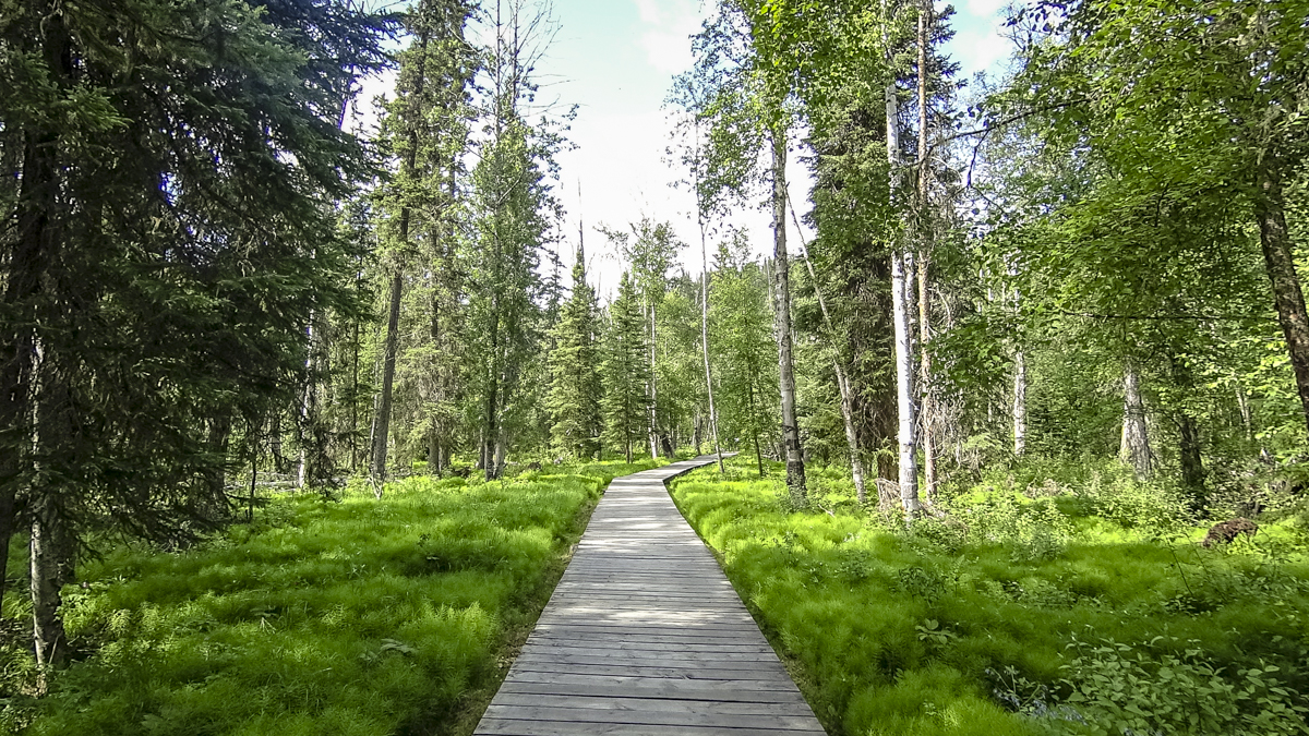
Rancheria Falls
There are lots of little hikes and scenic stops all along the way to Whitehorse but this particular stop claimed a waterfall, which always piques our interest.
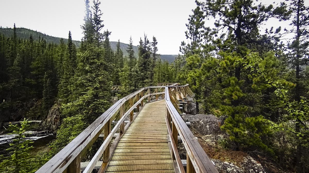
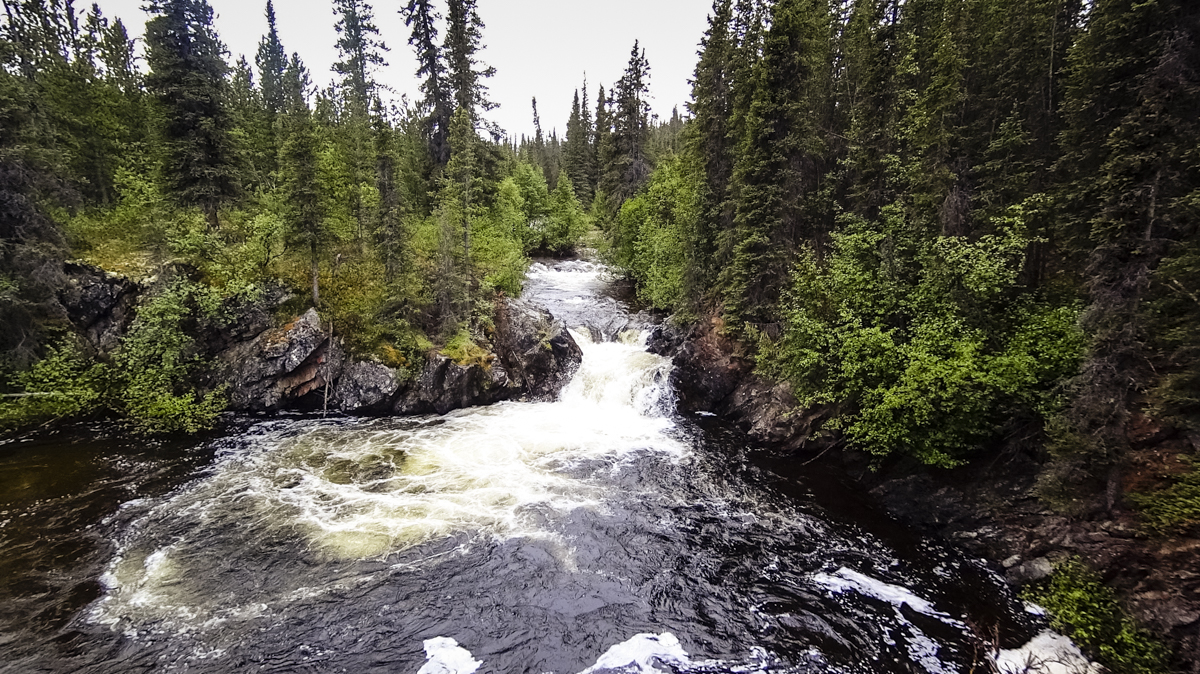
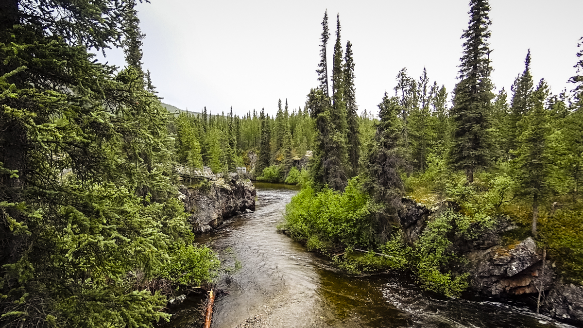
It was a super short walk to the falls following a boardwalk and while it wasn’t a huge waterfall, it was a lovely way to stretch our legs and enjoy some scenery. Sadly, the rain convinced us to leave the big camera behind so we relied on our trusty action cam to capture the moment.
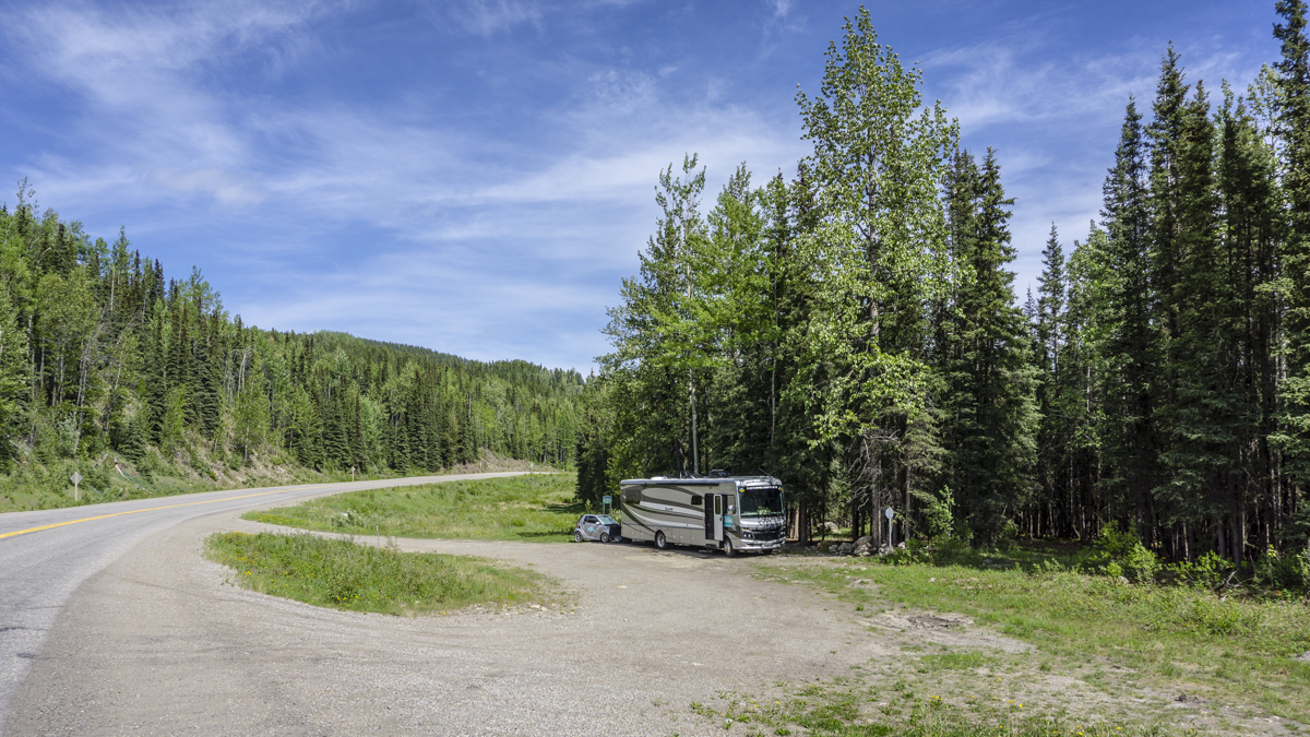
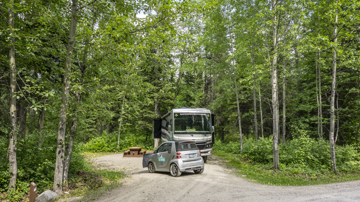
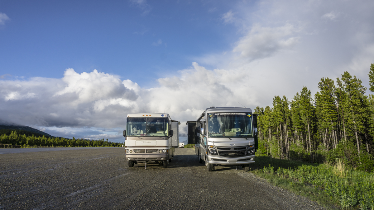
Roadside Pull Out Camping
Because of the remoteness of the Alaskan Highway and long stretches between campgrounds and towns its common practice to use a roadside pull out to catch some z’s before moving along. There are some rest areas and pull outs that will have signs saying No Overnight Camping but most don’t (thankfully). A lot of the campgrounds and pullouts are noted in the information from the visitors centers as well as the Travelers Guide to Alaskan Camping and The Milepost.
Good news is, around here even the roadside pull outs have great views! This stop is just about two hours shy of Whitehorse.
Road Report
Fuel Prices – Fuel came down in price a little once we crossed into the Yukon. We filled up in Watson Lake, YK at $1.17 per liter for gas.
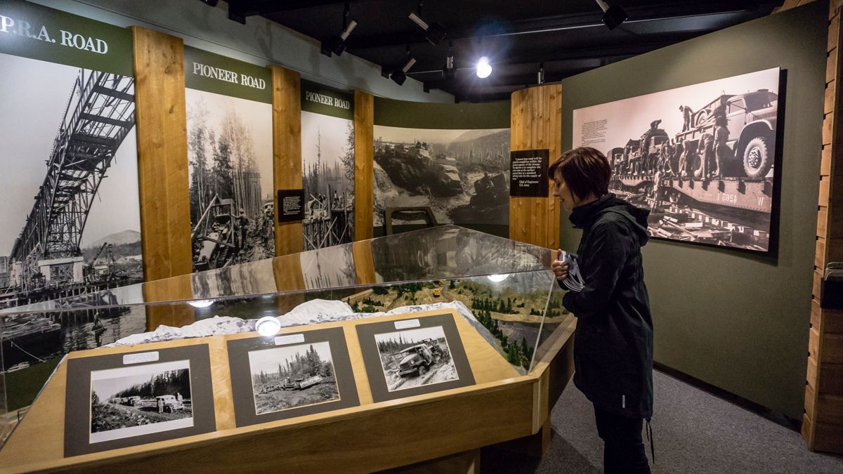
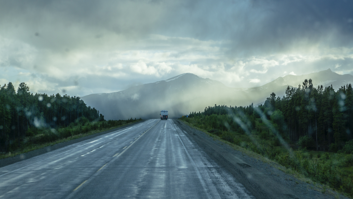
Road Conditions – You see, when we started this road trip we honestly didn’t know much about the Alaskan Highway, its history or what to expect. All we knew was what we had been told by fellow travelers: the highway was built in the 40’s through unmapped territory to defend America from threats in the Pacific. It’s legendary as being one of the toughest road trips you can take on, with RV demolishing rough and challenging roads. It’s incredibly wild and remote with limited services and heavily mosquito infested.
While this might have been the case in the past, here is what we’ve found so far: Some interesting historical references and relics from days past. The modern Alaska Highway is a far cry from the pioneer road that was cut through during World War II and the entire length of the highway is mostly paved and well maintained with only a couple of short stints of dirt roads. A little bumpy, yes but nothing crazy. There are miles of pristine wilderness, small but serviced towns and yes, they are still mosquito infested (so bring your bug spray).
Dates Visited – June 7 – June 11, 2015
See all our Alaska travels and tips here: Alaska Bound
Have you traveled the Alaskan Highway? What was your experience like? Tell us about it in the comments below!