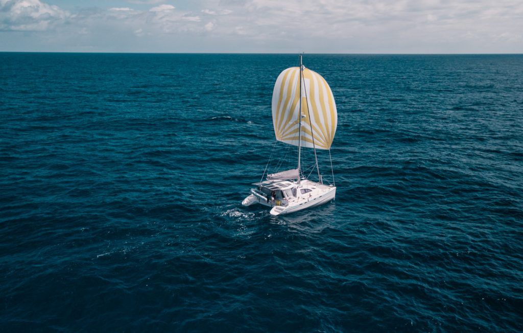
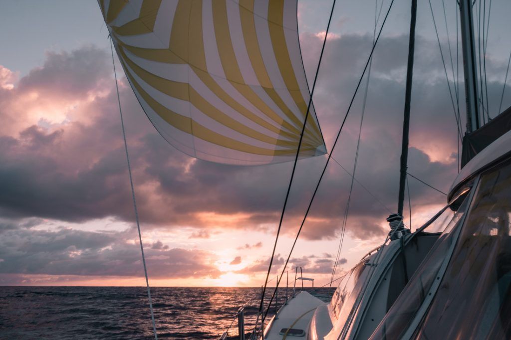
We’ve been at sea for over twenty days now and we’re down to the last few hundred nautical miles. It’s our last days at sea and we can almost smell land.
Knowing we’re on the home stretch gives us a heightened awareness of the journey we’re on and puts us in an introspective frame of mind.
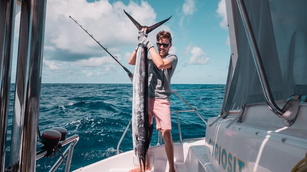
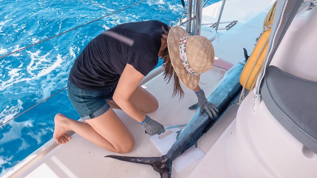
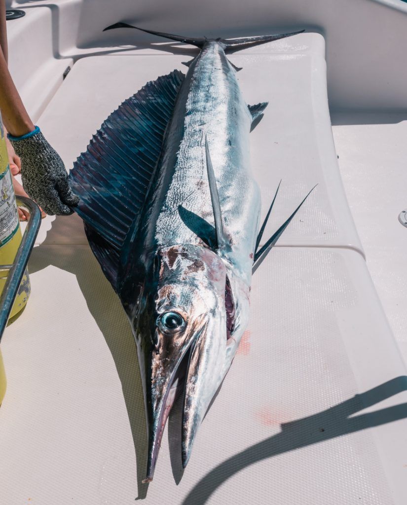
We diagnose our engine problem, almost sink the drone and a colossal catch steals the day. Join us for days twenty through twenty-three as we sail across the Pacific Ocean making our way to French Polynesia.
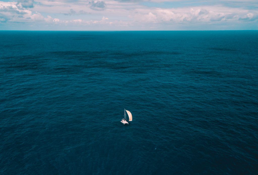
I still don’t know which move impressed me most. Jason gaffing that fish like he had done it a thousand times before or swooping in like superman to bring home the drone. The smooth downwind sailing really agrees with him. Well, that and knowing there’s only “one” more day to go (as long as the wind cooperates).
Portable Nav Station You Say?
You’ve seen us talk about using our ipad as a portable nav a few times now and I’ve gotten a lot of questions about it. I won’t dive into all the details, but I don’t want to leave all the inquiring minds hangin’.
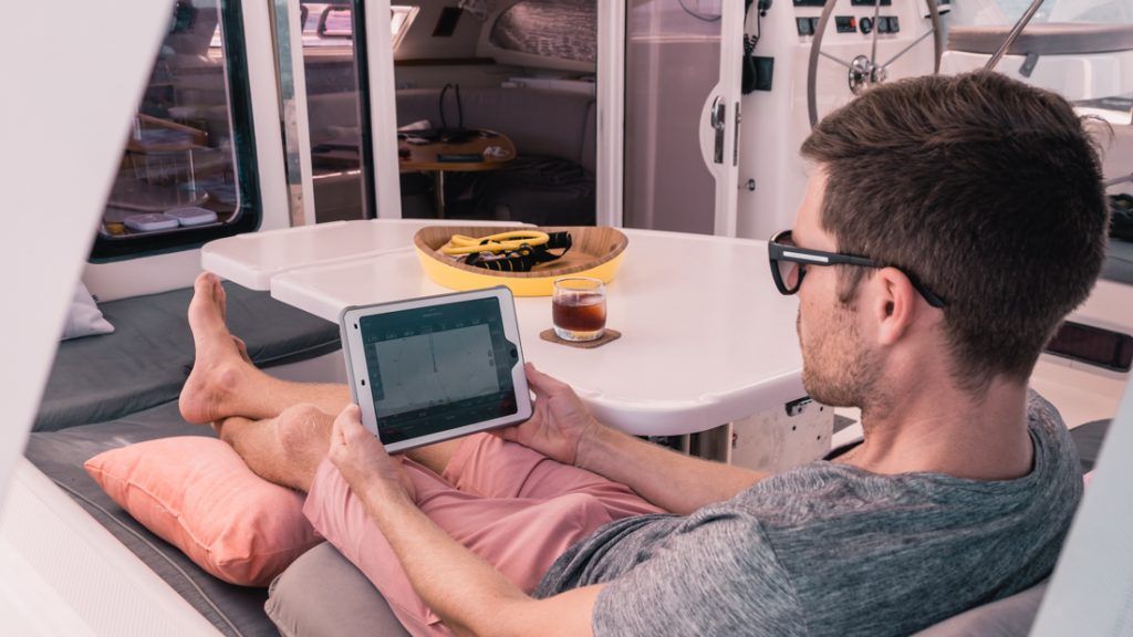
The wonderful world of technology and connected devices is infiltrating the marine world. While Garmin certainly isn’t the only one with options to connect other devices, they make a lot of extra-cool gadgets. It’s one of the big reasons we choose Garmin when replacing our nav gear on Curiosity.
We can connect our phone, tablet, smartwatch and our new camera all to our chartplotter using the built-in apps. With the ActiveCaptain app we can mirror our chartplotter and we can control everything the same as if we were at the helm. Plus, we can plan and view routes on our phone or ipad anytime, anywhere, and the information transfers as soon as we connect to our helm. This comes in handy when we’re at the local watering hole and a fellow sailor wants to share all their fave anchoring and SCUBA diving spots. Our charts are always with us.
And since I mentioned charts… I feel its important to say, we don’t only use Garmin charts. We also use Navionics charts on our mobile devices. We actively use and check both…backup & secondary charts in sketchy reef-laden areas is a must!
- Chartplotter: Garmin 7612xsv Multi-touch
- iPad Mount at Helm: http://amzn.to/2fT84PG Using iPad Pro: http://amzn.to/2d9Oopf
- Active Captain App (Free): http://bit.ly/active_captain
- Watch: gonewiththewynns.com/product/quatix-5-marine-watch
- Camera: https://amzn.to/2wX8HCq
- iNavx: http://bit.ly/2vGgC51
Gear Used In This Video
- In The Galley – Click on the Kitchen Faves tab: gonewiththewynns.com/store
- Working Out – gonewiththewynns.com/product/exercise-staying-fit
- Entertainment at Sea – Kindle: http://amzn.to/2mpGQ9K Audiobooks and podcasts are The Best on passage.
- Camera Gear – gonewiththewynns.com/camera-gear-review-2017
- Weather, Texting & Email at Sea:
- Iridium Go and Predict Wind: bit.ly/PredictWindIridium
- Garmin InReach: gonewiththewynns.com/product/inreach-satellite-communication-and-tracking
Sailing Report
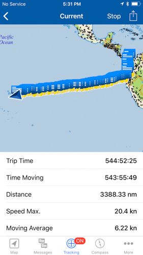
We use our Garmin InReach to track our sail and send updates to family & Patreons. We take a screen capture every day at 5:30pm, because that marks another 24hrs logged for our sail across the Pacific. It’s a fun way to follow along in real time and hear what’s happening on board. This video covers May 13-17, 2018. Here is the screen capture from May 17th. The little dots share real-time trip info and the little message pop-up is us writing to the people following along from home.